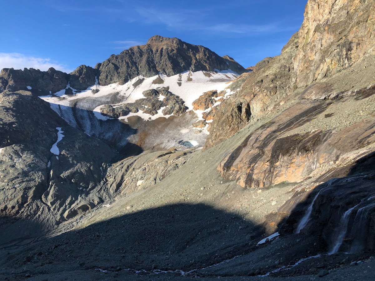
From the Chamanna Jenatsch, a track leads through the glacier foreland and over the steep step to the remains of the Vadret d'Err. If conditions are favourable in early summer, you can climb over the Vadret, but as the glacier has receded considerably, it is usually better to go around the rocky head 3141 on its northern side. Here the route leads over scree, boulders and rocky sections up to the glacier plateau. Cross the plateau to reach the firn ridge, which you cross between points 3203 and 3307 and, maintaining the height, reach the foot of the east ridge. From here there are several options:
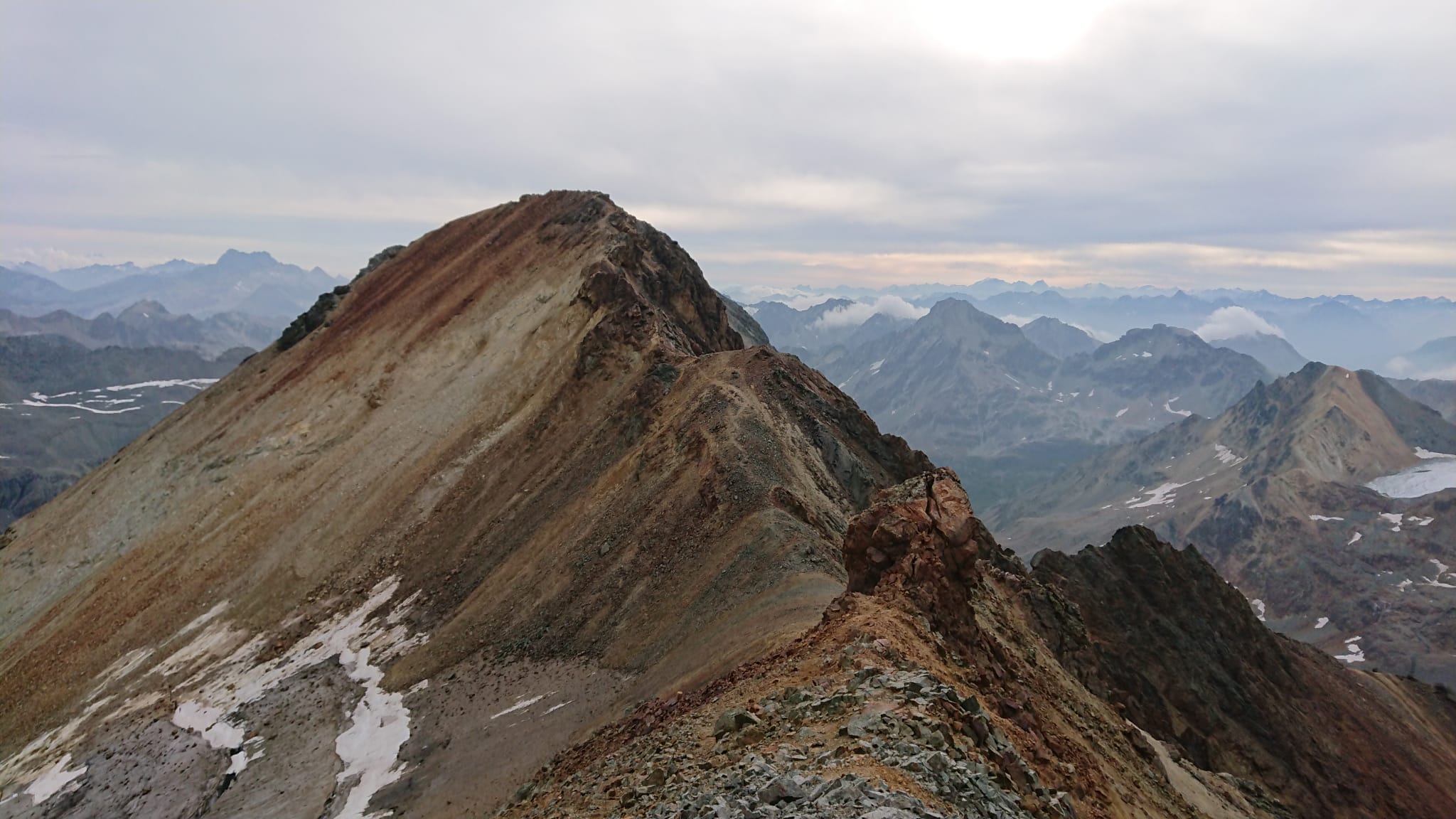
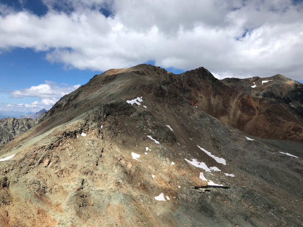
- the easiest variant is the south-west ridge (L). This route is therefore often chosen for the descent. From the saddle, cross the scree slope at the south foot of the summit structure and ascend via the south-west ridge, either on the left through boulder scree or on the right over the easy ridge with solid rock.
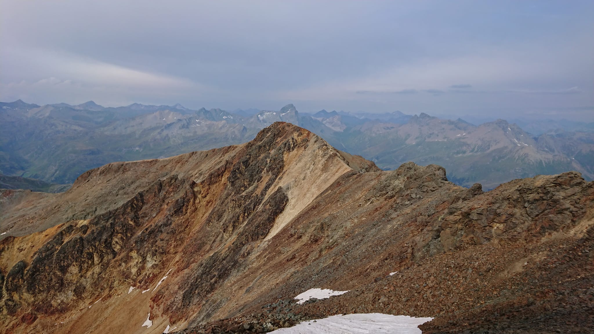
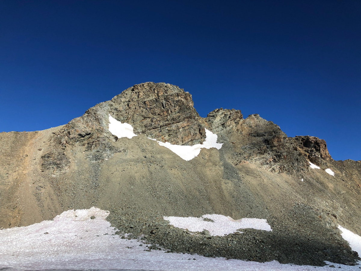
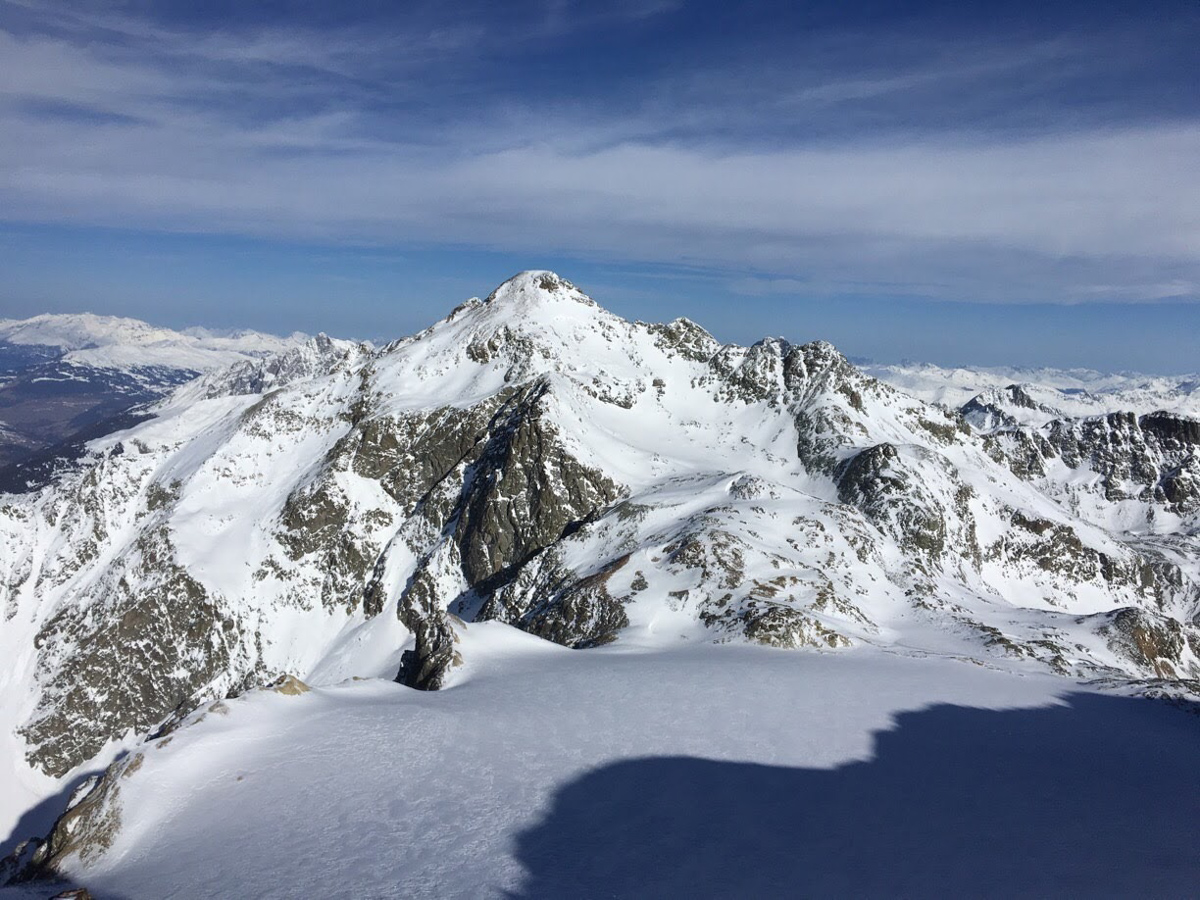
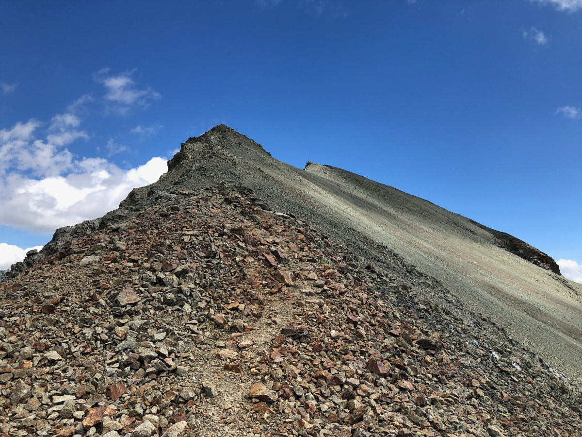
- The south-east ridge offers an easy but beautiful climb and is therefore the most popular route in summer (WS). From the saddle, climb over scree to the ridge. Bypass the first rock bar on the west side. Then follow the ridge or keep slightly to the left, not very difficult and in good rock to the summit.
Descent to Alp Flix:
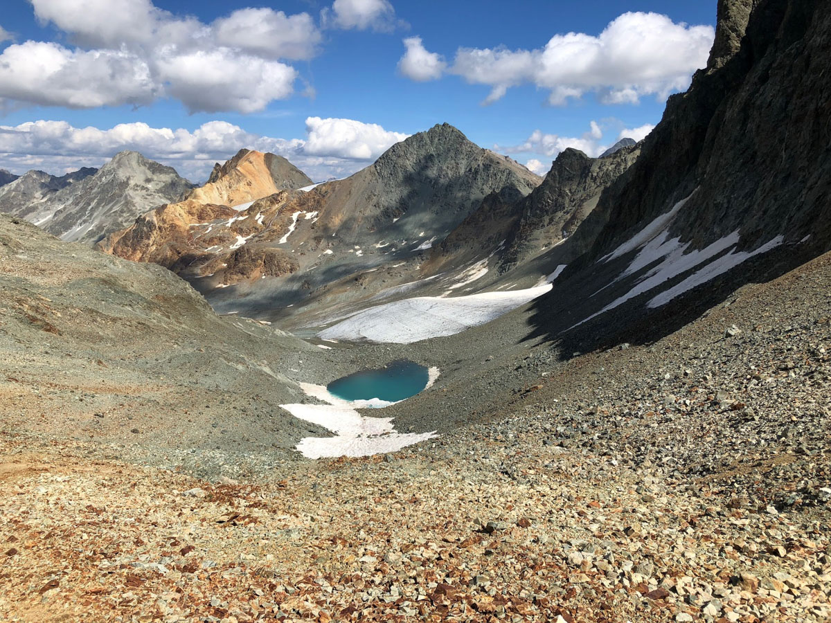
Back at the saddle, it is possible to descend through a steep couloir via Tellers Davains to Alp Flix. Lot of loose rocks, best if there is still some snow left.
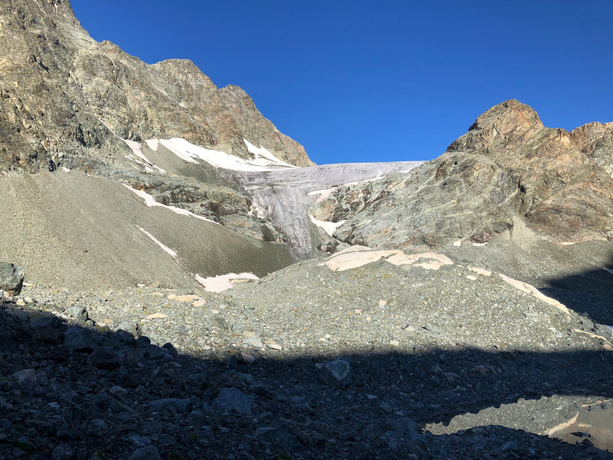
From the hut, follow the tracks across the glacier forefield. The glacier retreats fast and the rocks appear more and more on the steep step. You can either make a shorter but steep ascent towards the south-west to the glacier plateau, or make a wide arc towards the south and follow the foot of Piz Picuogl to the glacier plateau. Pass the 3164 m rocky crest to the west and ascend the upper firn slope, finally keeping slightly to the left. The summit head is climbed on paths through the boulder scree of the southern slope.
Alternaticve options:
The north ridge is a less pronounced rocky ridge, the east ridge is a sharp-edged ridge and drops from the summit over two larger rocky humps. Both routes are categorised as ZS.
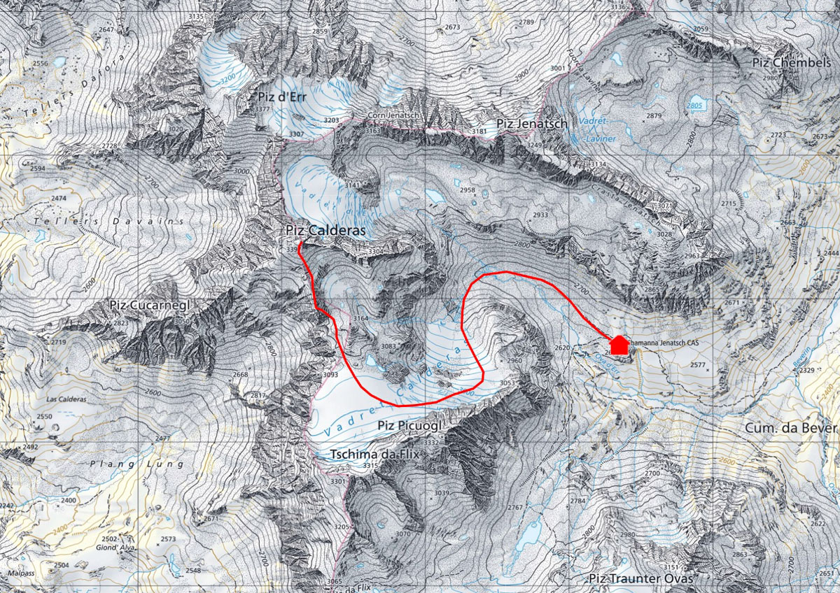
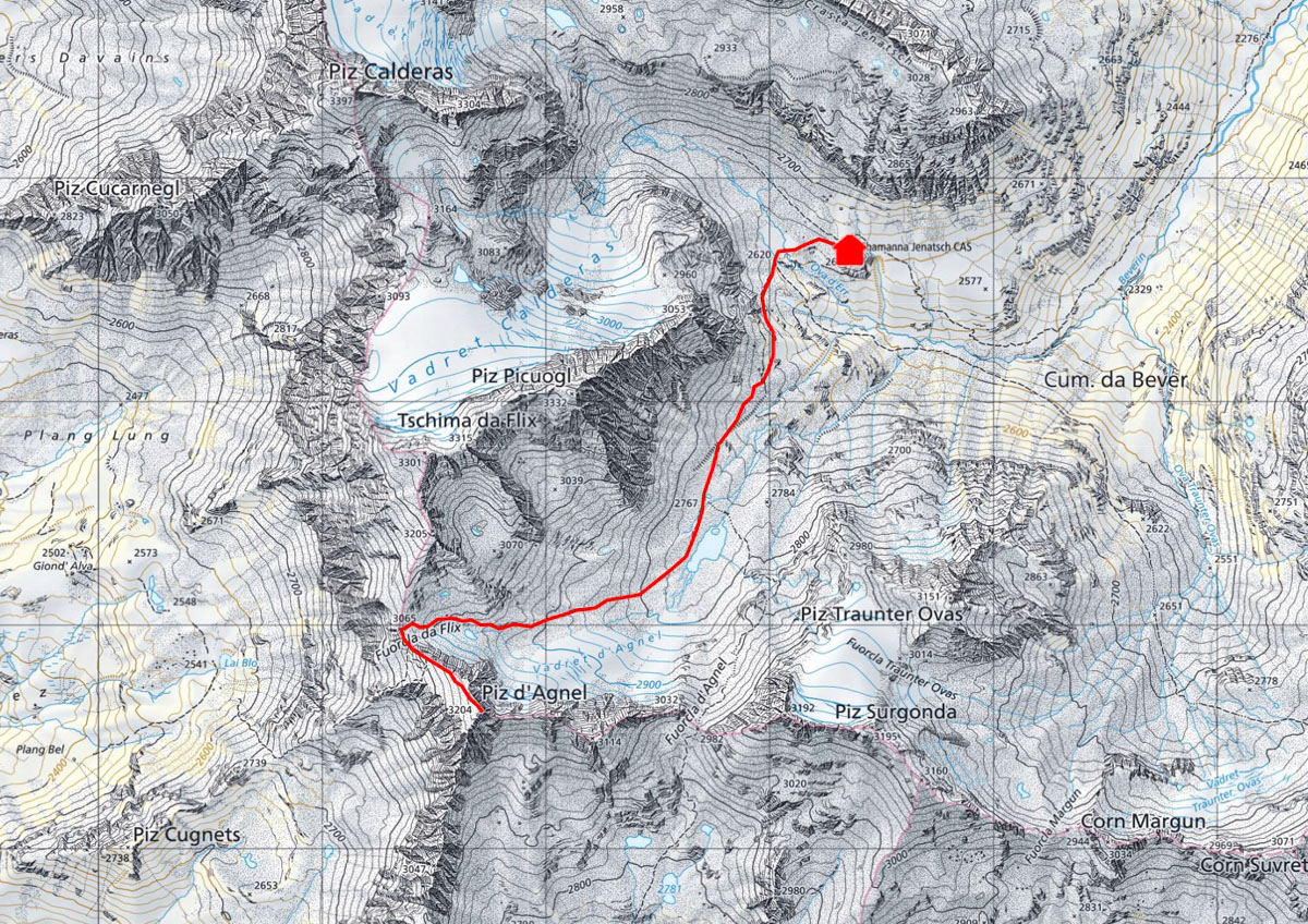
Follow the hiking trail towards Fuorcla d'Agnel as far as to the glacial lake. Then do not cross the bridge, but follow the path on the western side of the lake (unmarked) to Fuorcla da Flix. Follow the broad ridge to the summit.
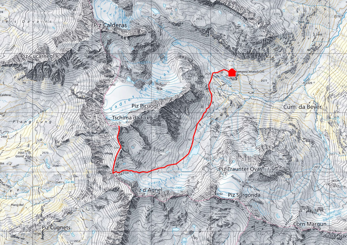
From the hut, follow the same route as for Piz Calderas to the glacier plateau. From here, climb up over a firn or scree flank to a small pass between points 3301 and 3315. From there, head west and bypass a small rock tower on the right-hand side. You are already on the broad summit and can enjoy the view.
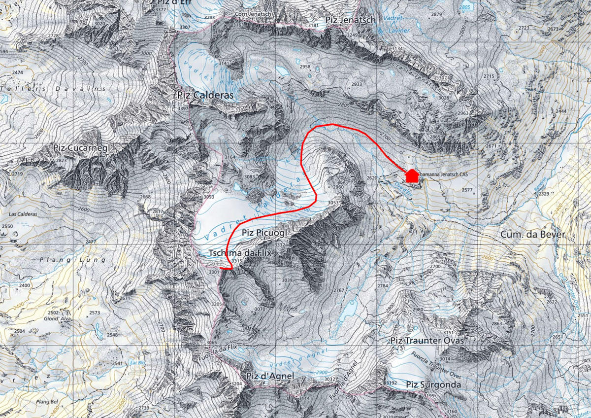
Follow the same route to Fuorcla da Flix as described in the tour description for Tschima da Flix. From there, follow the screey, slightly exposed flank to the summit.
For the normal route, climb the same as for the Tschima da Flix via the Vadret Calderas to the pass below the Tschima da Flix. From here, follow the ridge, sometimes on walking terrain, sometimes easy climbing (sections II-).
If you want to avoid the glacier, you can of course ascend via Fuorcla da Flix and Tschima da Flix.
Alternatives to the rock pyramid are the north ridge (ZS) and the south-east ridge (WS).